
The role of Artificial Intelligence in navigation is progressing with time. With advancements in computer programing through machine learning models, AI is playing a role in today’s navigation industry. Navigation is a vast field and has applications in various domains like shipping, aviation, space, and the traditional transport industry. Efficient navigation helps supply chain bottlenecks be reduced and benefits businesses.
Table of Contents
- What is Navigation?
- How does Navigation in Mode of Transport work?
- First, understand how the Human Mind process Navigation
- The concept of Navigation works similarly to Human Mind Navigation
- Role of “Artificial Intelligence in Navigation”
- Differences between Traditional Navigation and AI-assisted Satellite Navigation
- Conclusion
What is Navigation?
It is the study that focuses on the process of monitoring and processing the information to find the right direction in the transport industry. This is done by finding the direction from one point to another in the shortest time. With the least obstacles, which may be due to traffic, topographical location, or other physical characteristics of the environment.
How does Navigation in Mode of Transport work?
To understand this, we need to compare it to the human mind. How our mind learns directions and remembers them. Information in our mind flows from one to another nerve in the shortest possible time so that we can act upon it. Our mind is made of millions of nerves that Crisscross and overlap each other thousands of times. Still, our mind is able to transmit information from one nerve to another so that we can take action in the shortest possible time.
First, understand how the Human Mind process Navigation
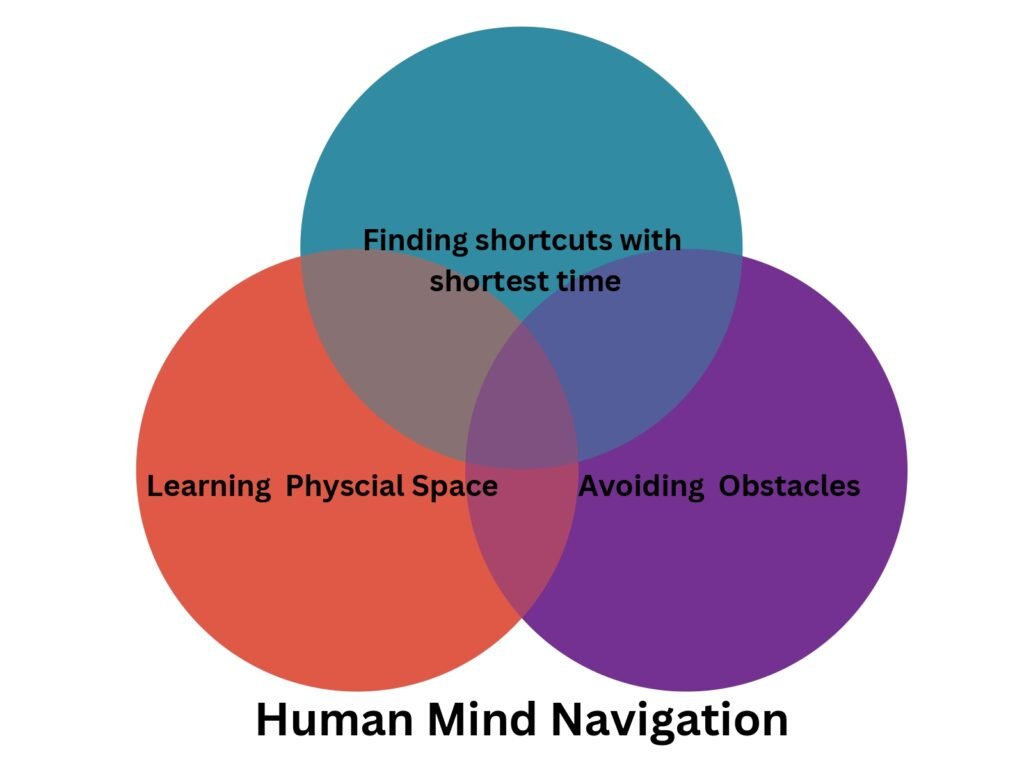
The human brain consists of billions of cells. These cells are divided into different groups that perform different tasks. Navigation through the human mind is possible due to three types of cells each performing specific functions. Spatial reasoning and positioning systems through the human mind are possible due to these cell groups. Place cells are responsible for remembering previously visited locations. Head direction cells maintain a sense of direction to these locations. And Grid cells divide the physical space into a coordinate system to create an internal map. All these cells work in sync to help humans explore new places and remember the direction for them.
The concept of Navigation works similarly to Human Mind Navigation
Traditional navigation relied on maps created decades ago and less frequently updated over time. This process is not efficient in saving time and finding the shortest way to travel.
Thus, GPS navigation started with many big companies mapping the geographical map of the areas which were of interest to them. Google used it by sending its vehicles equipped with cameras to capture real-time images of the cities and incorporating them into their google maps which many of us use today to commute.
It had its own drawbacks: Areas that were of lesser commercial value to these large technology companies were not properly mapped or were omitted altogether. Countries that are adversaries of these companies’ host country, the United States, were also omitted or only sparsely mapped. Such as Iran, North Korea, and Russia were not mapped or were mapped sparsely. Users of these countries using maps provided by tech companies often faced not accurate information or wrong mapping which led to confusion and delays in their travel.
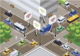
Role of “Artificial Intelligence in Navigation”
To overcome these challenges in digital maps many research organizations are using Artificial Intelligence. One of the most widely available real-time updated images of locations is through satellite imaging. As its continuously updated satellite imaging brings more real-time information to users.
The biggest challenge in reading satellite imaging is to read, learn and act based on given data. Research Institute MIT in corporation with Qatar Computing Research Institute has developed a machine learning model called Road Tagger.

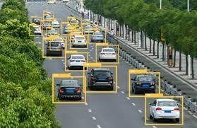
The Road Tagger AI model uses satellite imagery of road features in digital maps to improve GPS navigation. These features include showing lane counts, parking spots available in real-time, road width, dedicated emergency lanes created in case of sudden accidents, etc. These features in GPS navigation help users make effective decisions in planning their journey.
This model at present is tested in 20 cities in the US to tag road features in real-time and predict uncovered locations based on its learning. This Machine learning model has neural network architecture to automatically predict lane-type city roads or highways. It can also predict with high accuracy parking spots availability, road congestion hidden behind any obstruction due to trees or buildings, etc. It has a combination of a Convolutional Neural Network (CNN) and a Graph Neural Network (GNN).
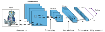
CNN and GNN AI models
CNN models are commonly used for image processing tasks. Whereas the GNN model is used for relationships between connected nodes in graphs which is popularly used in analyzing social networks. The Road Tagger ai model feeds raw data from satellite imagery. And automatically produces output with an accuracy of over 72% without human intervention.
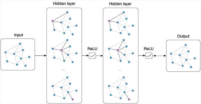
The CNN takes as input raw satellite images of target roads. The GNN breaks the road into roughly 20-meter segments, or “tiles.” Each tile is a separate graph node, connected by lines along the road. For each node, the CNN extracts road features and shares that information with its immediate neighbors. Road information propagates along the whole graph, with each node receiving some information about road attributes in every other node. If a certain tile is occluded in an image, Road Tagger uses information from all tiles along the road to predict what’s behind the obstructions.
The researchers hope to use Road Tagger to help humans rapidly validate and approve continuous modifications to infrastructure in datasets of maps, where many maps don’t contain lane counts or other details. “Roads that were once labeled as dirt roads have been paved over so are better to drive on, and some intersections have been completely built over. There are changes every year, but digital maps are out of date. Such AI models are helping in updating these changes in maps continuously to improve the experience of users using these maps.
Differences between Traditional Navigation and AI-assisted Satellite Navigation
| Characteristics Difference | Traditional Navigation | AI-assisted Satellite Navigation |
| Source of Maps | Digitally mapped by satellite or through vehicles equipped with cameras to capture real-time images of cities | Continuously mapped the locations through satellites which bring more real-time situational awareness almost all over the world |
| Accuracy | Mostly accurate in the regions it has covered physically | High level of Accuracy with real-time physical situational data |
| Governance | Highly controlled and moderated by tech companies based on their business potential or countries in which they operate | Since its decontrolled gives freedom to the user to get information without being discriminated against due to their nationality, geographical location, or business value |
| Challenge | Not able to update real-time data such as parking spot availability, emergency road creation in case of accidents, new infrastructure developments on roads, etc | Able to update its model based on real-time satellite imagery thus able to provide highly accurate data of parking spots, roads hidden behind trees or temporary structures, or new structures constructed |
Conclusion
Artificial intelligence is making its inroads in the navigation industry slowly. As time passes new improved machine learning models for navigation are developed. It will help to streamline the transport industry through more accurate results from AI-assisted navigation. This is going to bring cost benefits to the shipping industry, aviation, and road transport industry. These benefits will not only be in terms of money, and time saved. But also help in reducing environmental pollution caused due to transportation industry.
If you like this article you may be interested in finding out how AI is playing its role in Investment banking read it here
Pingback: Artificial Intelligence(AI) in Healthcare - Techaninfo
Pingback: The Saga of Artificial Intelligence in Agriculture - Techaninfo